
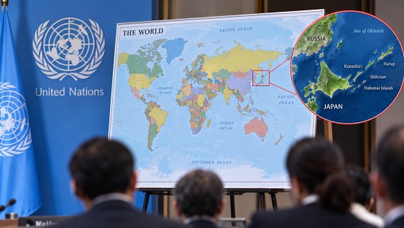
A newly adopted world map utilizing the Equal Earth projection has ignited controversy, particularly over how it represents certain territories. Japan has voiced concerns regarding the depiction of the Kuril Islands, urging for alterations. The Equal Earth projection, which aims to portray the continents’ relative sizes more accurately than the traditional Mercator projection, results in a noticeably larger Africa and smaller Europe and North America compared to many standard maps.
The Kuril Islands, referred to by Japan as the Northern Territories, are displayed in the same color as Russia on this new map, a choice Japan argues might mislead viewers about the status of the territory. This chain of islands, situated between Japan’s northern region and Russia’s Kamchatka Peninsula, has been a long-standing point of contention, reflecting deeper historical and geographical issues between the two nations.
This debate underscores the power of map design in shaping perceptions of borders, territories, and geographic ownership. Different projections can alter the visual representation of countries and continents without affecting their actual size or location. The Equal Earth projection specifically was created to offer a more balanced view of the world’s landmasses, maintaining the proportional size of continents while presenting a complete view of the globe. This contrasts with the Mercator projection, which can exaggerate the size of regions near the poles.
The disagreement over the new map serves as a reminder that maps are more than just tools for navigation; they carry cultural and political significance. The colors, borders, and labels used in mapping can convey powerful messages, particularly in areas where territorial disputes persist. For travelers and geography enthusiasts, the Equal Earth projection provides a fresh perspective, illustrating how the appearance of well-known destinations can shift dramatically depending on the mapping system employed.